November 11th, 2026
Mawryngkhang Trek: Meghalaya’s Thrilling Bamboo Trail to the King of Stones
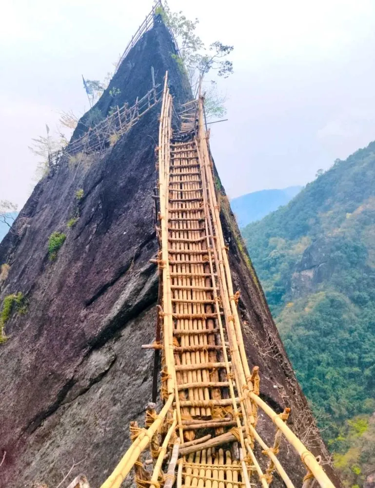
Most people come to Meghalaya for waterfalls and living root bridges. A few hours from Shillong, a small Khasi village has built something wilder: a trail of hand-lashed bamboo bridges, ladders and walkways pinned to sheer cliffs above a rushing river, leading to a giant monolith the villagers call the “King of Stones”. This is the Mawryngkhang trek, better known as the Bamboo Trek of Meghalaya. Here is everything you need to know before you go.
Mawryngkhang trek at a glance
| Start point | Wahkhen village, Pynursla, East Khasi Hills |
| Distance from Shillong | About 45–55 km; roughly 2 hours by road via the Shillong–Dawki highway |
| Trek length | About 3.5 km round trip |
| Time needed | 3–5 hours at a comfortable pace |
| Difficulty | Moderate; exposed sections need a head for heights |
| Best season | October to April (November–February is driest) |
| Permits | None; a small community entry fee is collected at Wahkhen |
The story behind the trail
The Bamboo Trail is a community achievement. The people of Wahkhen — a village of around a thousand residents — built the entire route themselves, without outside funding, and opened it in 2016. The trail is still maintained by the village; it is closed from time to time for repairs, usually after the monsoon, and reopens once the bamboo has been replaced. Every entry fee you pay goes back into that upkeep.
The destination, U Mawryngkhang, is a towering standalone rock often described as the largest single monolith in Meghalaya. “U” is a Khasi term of respect, and the name translates loosely as the King of Stones. Local legend tells of the stone-king’s love for Kthiang, a story your Wahkhen guide will happily recount at the top.
The route, step by step
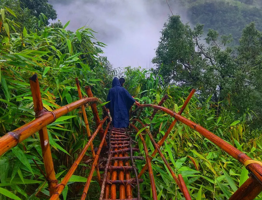
The trail follows a classic sequence: Wahkhen village → Wahrew river → Mawkhlieng cliff → Mawmoit viewpoint → Mawryngkhang rock.
- Wahkhen to the Wahrew river. The walk starts gently through broom-grass fields and village paths, then drops steeply on stone and earth steps to the river.
- Along the Wahrew. Here the bamboo begins: narrow walkways bound with cane and rope run along the cliff face just above the water, with short bamboo bridges across side streams.
- Mawkhlieng cliff. The most thrilling stretch — the bamboo path clings to the rock with a sheer drop below. Move slowly, keep three points of contact and step only where the bamboo is lashed.
- Mawmoit viewpoint. A natural rest stop with sweeping views over the gorge and the forested hills of the East Khasi range.
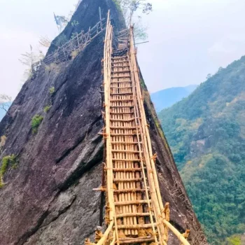
- The final climb to Mawryngkhang. Steep bamboo ladders lead up the side of the monolith to a ledge with a 360-degree view. On clear days you can see far across the Khasi Hills.
Remember that the return is the reverse — including the climb back up from the river to Wahkhen, which most trekkers find the toughest part of the day.
How difficult is the Bamboo Trek?
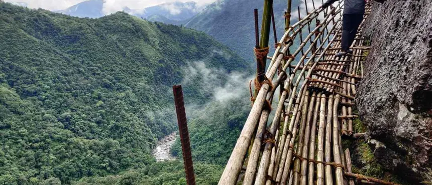
The distance is short, but the terrain is not. Expect uneven steps, steep descents, swaying bamboo and genuine exposure on the cliff sections. Anyone with average fitness and no serious fear of heights can do it at a careful pace. It is not suitable for very young children, people with vertigo or knee problems, or anyone who is unsteady on their feet. Locals may run it in under an hour; plan for four.
Best time to go
- October–April: dry bamboo, firmer steps and clear views — the recommended window.
- November–February: the safest and most comfortable months; cool mornings, sunny days.
- May–September: heavy rain makes the bamboo slippery and the river high; sections may be closed for repairs. Avoid unless the village confirms the trail is open.
Start early: aim to begin by 9 am to finish well before the light fades in the afternoon. See our best time to visit Northeast India guide for the wider season picture.
How to reach Wahkhen
- From Shillong: drive towards Dawki on the Shillong–Dawki road, turning off near Pomlum and following signs to Wahkhen. A private car is the most practical option and lets you combine the trek with other stops the same day.
- Nearest airport and railhead: Guwahati, about 3 hours from Shillong; Shillong’s small Umroi airport has limited flights.
- Parking: available at the trail entrance for a small fee.
Fees and guides
The village collects a modest entry fee per person at the start, plus a small parking charge; rates are revised from time to time, so carry cash. Local guides are available and worth hiring — they know which sections are being repaired, they share the legends, and your fee directly supports the community that built the trail.
What to carry and wear
- Trekking shoes with good grip — never sandals or flip-flops on bamboo.
- A light daypack, so both hands stay free on ladders.
- At least 1.5–2 litres of water and snacks; there are few shops on the trail.
- A light rain jacket in any season, plus sunscreen and a cap.
- A phone strap or pouch — dropped phones on the cliff sections are rarely recovered.
Safety tips
- Check that the trail is open before you set out, especially after heavy rain.
- Walk single file and let one person cross a bamboo bridge at a time where it is narrow.
- Test each step before you put your full weight on it.
- Do not stop for selfies on exposed sections; use the viewpoints.
- Turn back if it starts raining hard — wet bamboo is very slippery.
Make a day of it: nearby places
Wahkhen sits close to some of Meghalaya’s best-loved sights on the Dawki road, so it is easy to build a full day or two around the trek:
- Kongthong, the “whistling village”, where each villager has a melody for a name.
- Mawlynnong and the Riwai living root bridge.
- Dawki and Shnongpdeng for boating on the clear Umngot river in winter.
Meghalaya Tourism also includes Wahkhen and an optional Bamboo Trail day on its longer Wahlyngkhat–Nongblai–Wahkhen–Kongthong village trek. For more quiet corners, read Meghalaya’s hidden places.
Do the Bamboo Trek with a local team. We arrange private transfers from Shillong, an experienced Wahkhen guide and a relaxed day combining Mawryngkhang with Kongthong or Dawki. See our Meghalaya tour or ask for a private itinerary.
Frequently asked questions
Where is the Mawryngkhang trek?
It starts in Wahkhen village, Pynursla, in Meghalaya’s East Khasi Hills, about two hours from Shillong.
How long is the Mawryngkhang Bamboo Trek?
About 3.5 km round trip, taking 3–5 hours including stops.
Is the Bamboo Trek safe?
Yes, when done in dry weather, at a careful pace and with a local guide. The trail is maintained by the village, but it is exposed, so it is not for anyone with a strong fear of heights.
Can beginners do the Mawryngkhang trek?
Fit beginners can, if they are comfortable with heights and take it slowly. The steep return climb is the hardest part.
Is the trek open during the monsoon?
Sections can close for safety and repairs during and after heavy rain. October to April is the best time; confirm the trail status before visiting.
Latest Posts





Woahhh! Hello there! Stop! You don't wanna do this.
Get
Quotes


